Upper Spencer Brook Valley
Year Acquired: 1977-2009
Size: 83 acres
Miles of Trails: 4 miles on Land Trust Land
Features: Dramatic ravine, “wolf trees”, Spencer Brook, ledge outcroppings.
Overview
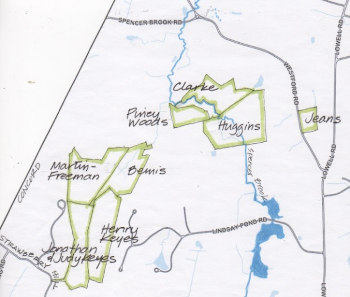
The Land Trust’s open space in the Upper Spencer Brook Valley totals a substantial 83 acres, but what is truly remarkable is that this resource was assembled over 33 years from eight different owners. And this does not even count the abutting 73 acres of private land protected by conservation restrictions. This is a highly varied landscape: the terrain rises from marshes and streams meandering toward Spencer Brook to upland pastures and bold ledge outcroppings creating a ravine unusual to Concord. Many stone walls indicate both old property lines and former pasture fields, since grown over into woods.
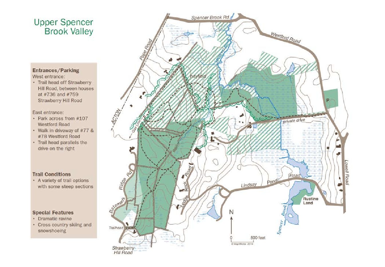
Trails: A variety of trail options with some steep sections. The trails that run through 50 acres in the northern portion of this area are in private ownership and subject to a conservation restriction held by the Land Trust; visitors are asked to keep to the trails shown on the Land Trust’s map, and observe posted rules and signs.
Entrances/Parking: West Entrance: Pedestrian access only at trail head off Strawberry Hill Road, between houses #736 and #759. East Entrance: Park in the Jeans Land field across from #107 Westford Road. Walk in on the driveway of houses #77 and #78 Westford Road. The trailhead will be on the right approximately 500 feet in.
Map Legend

Icons on the map can be clicked to get directions on Google Maps (works best for Parking Icons). Many Land Trust properties have trails that cross onto other land. Please stay on trails and abide by posted signs.
Explore the Land
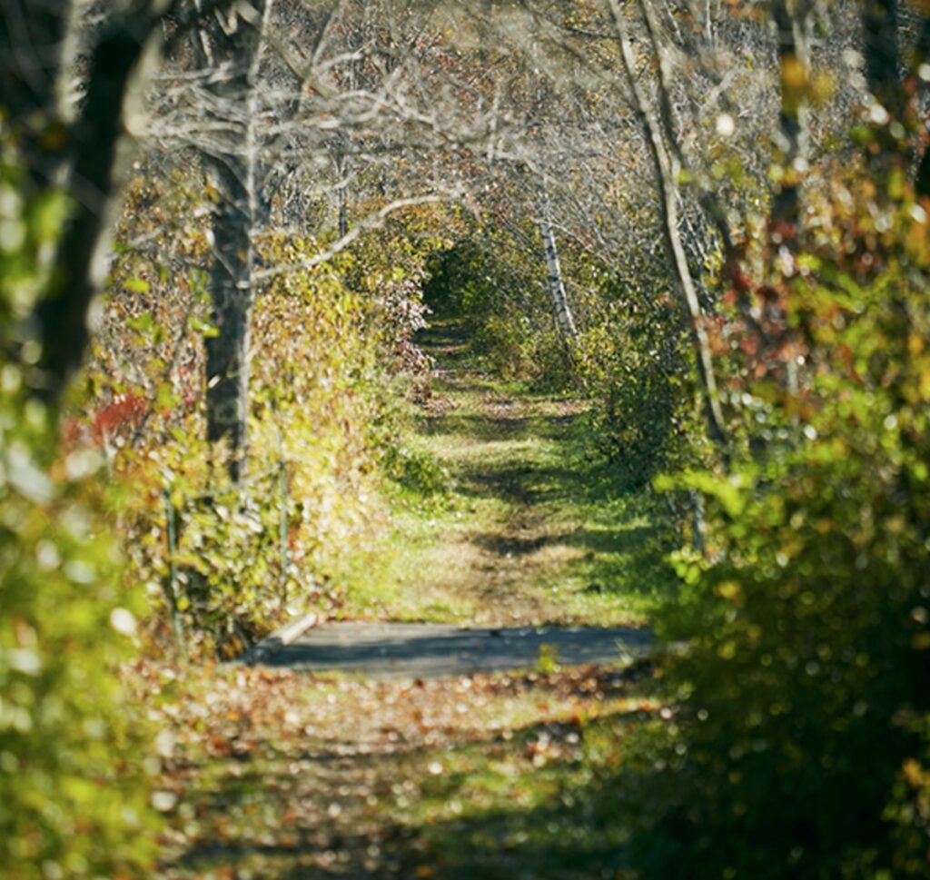
This property has over 4 miles of trail that cross over conservation restriction land (observe posted rules and signs) and Land Trust property. The trails vary from forest to field cover, and the elevation changes dramatically in the forest. For those who are unfamiliar with the property, a map is recommended for exploring, as there are several secondary trails.
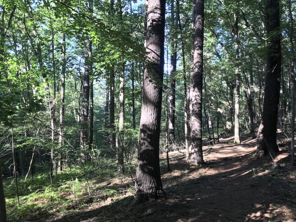
The trail coming from Westford Road parallels a residential driveway and brings visitors to a bridge over Spencer Brook. Because of the beaver activity here in recent years, the trail can be seasonally wet. As the trail turns north and west, it traverses a forest of even-aged, mature pines – the Piney Woods – with beautiful views down onto the meanders of Spencer Brook.
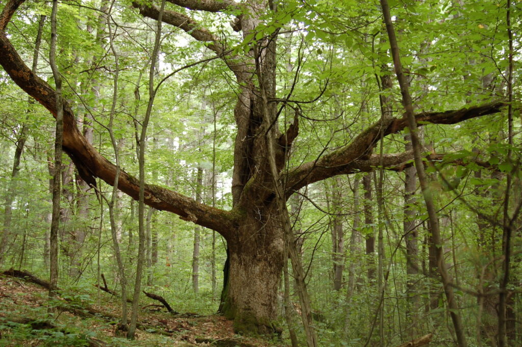
At the trail junction, look straight ahead to find a “wolf tree.” Historically, some of the forested areas of Concord used to be open meadows and pastures for animals. Wolf trees are trees that did not get cut down when creating these areas. These trees are old with large girth and spreading branches. They are often surrounded by smaller trees, indicating that they once were the only trees in the area.
At the junction, the trail to the north continues onto private property, where the trail system affords a walk around an expansive hayfield before reentering the woods. To the south, after passing a pasture (privately owned) and bypassing the first trail to the left, the main trail enters rocky, wet, and irregular terrain. Please stay on the trails and abide by posted signs.
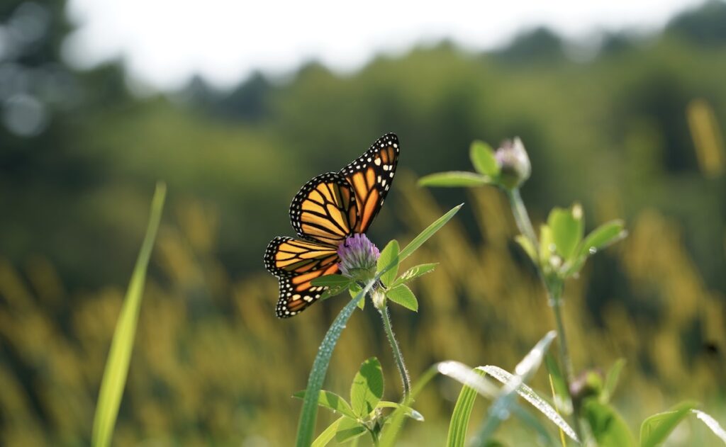
In several wet swales and streams, various plants emerge as the seasons change, including cinnamon ferns, skunk cabbages, and false hellebores. Along the trail, spicebush, a native shrub, can be found near wet areas. In the understory of the forest, there are two common plants that are characteristic of acidic oak wetlands in New England: star flower and canada mayflower. The forest is also covered with partridge berry and creeping dewberry. There are several giant oaks, or “wolf trees” as mentioned above, whose lower spreading limbs tell of their earlier life in open pastures.
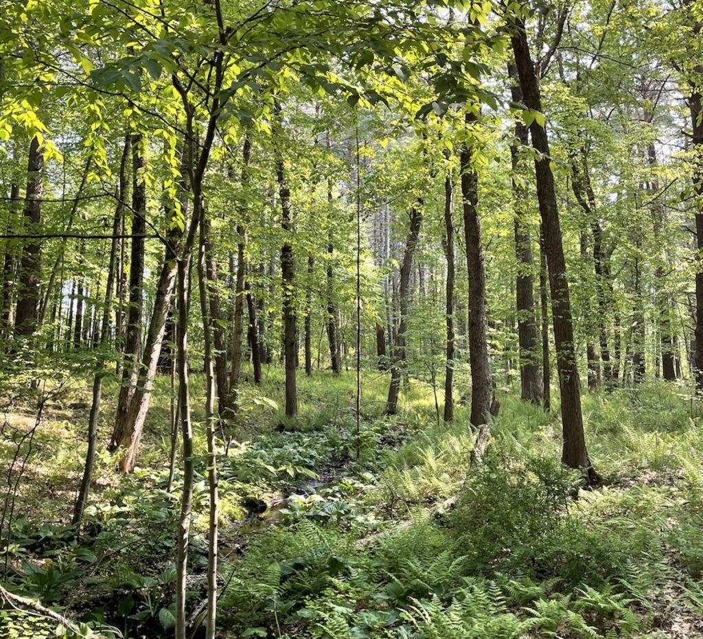
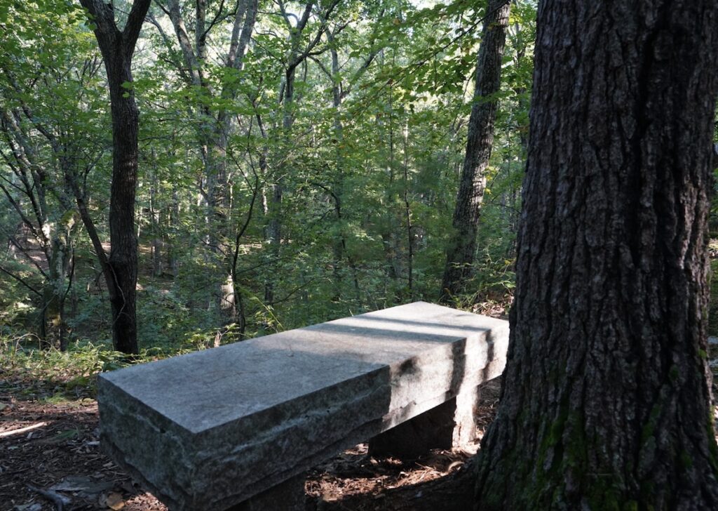
Throughout the forest here and to the south, many stone walls indicate both old property lines and former pasture fields, since grown over into woods. A pair of parallel walls tells of a cattle run used to guide livestock from the pasture off Pope Road down to water in the ravine. Continuing on, the grade rises to an overlook and a bench commemorating one of the Land Trust’s benefactors, Alan and Mary Bemis. This ridge is defined by steep ledgerock, making the ravine a surprising sight for Concord. At this point, the trail continues south to Strawberry Hill Road through mixed deciduous woods; alternatively, several side trails form loops back toward the Piney Woods.
History of Preservation
This property was acquired as a number of smaller parcels of land over 33 years. All these parcels connect to form the Upper Spencer Brook Valley property.
Henry Keyes, the first land donor, gave 15 acres off Strawberry Hill Road in 1976. He was followed in 1977 and 1980 by Winifred H. Clarke and James Russell Clarke Jr., who donated eight acres just north of Spencer Brook off Westford Road. J. Russell Clarke was one of the first trustees of the Land Trust and made significant contributions to previous projects. He helped immensely in the preservation of Estabrook Woods in the early 1960s.
The Bemis Land was acquired as gifts from Mary and Alan Bemis in 1977 and 1985. This 11-acre, wooded property contains a ravine with an attractive rock outcropping near the top of the ridge.
The Huggins Land was purchased in 1978 and comprises 18 acres off Westford Road. The trailhead from the east is located here.
The Freeman/Martin Land was donated by Lynn Ellen Freeman and Peter Martin in 1996. This 14-acre parcel abuts the Bemis and Keyes Land.
In 2000, the Land Trust purchased the ‘Piney Woods,’ a 4.5-acre parcel, from Joanie Callahan, with the aid of donations from neighbors and other Land Trust members.
The second Keyes donation, given in 2002 by Judy and Jonathan Keyes, consists of almost 13 acres of forest off Strawberry Hill Road. This parcel was a woodlot that had been in the Keyes family since 1927; Jonathan remembers going there three or four times a year to cut firewood. A conservation restriction was placed on the parcel in 1977 just after his father, Henry, donated the adjacent parcel. It was anticipated that this parcel would eventually be donated to the Land Trust and finally was in 2002. This parcel connects the trails in Upper Spencer Brook Valley to Strawberry Hill Road.
The Jeans Land was initially purchased by the Concord Open Land Foundation (COLF), an affiliate of the Land Trust, and then transferred to the Land Trust in 2009. A small section of this 2.7-acre field on Westford Road provides parking for the east entrance to the Upper Spencer Brook Valley properties